The Grand Staircase is an immense sequence of sedimentary rock layers that stretch south from Bryce Canyon National Park through Zion National Park and into the Grand Canyon. In the 1870s, geologist Clarence Dutton first conceptualized this region as a huge stairway ascending out of the bottom of the Grand Canyon northward with the cliff edge of each layer forming giant steps. . . .
What makes the Grand Staircase . . . unique is that it preserves more Earth history than any other place on Earth. . . . [T]he Grand Staircase and the lower cliffs that comprise the Grand Canyon remain largely intact speaking to over 600 million years of continuous Earth history with only a few paragraphs missing here and there. — National Park Service
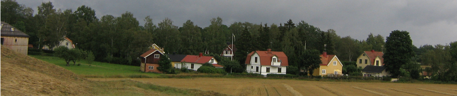
We had arrived the previous night at Bryce Canyon City, so we just needed to eat breakfast and head out to the park 3 miles down the road. Although I didn’t see them in order, I’ve been to Zion, the Grand Canyon, and we’ve now arrived at the top of the stairs. Our motel was at about 7,700 feet above sea level. We definitely noticed the altitude! If you have never experienced it, it takes time to acclimate to the thinner air, and we found ourselves huffing and puffing even on short walks.
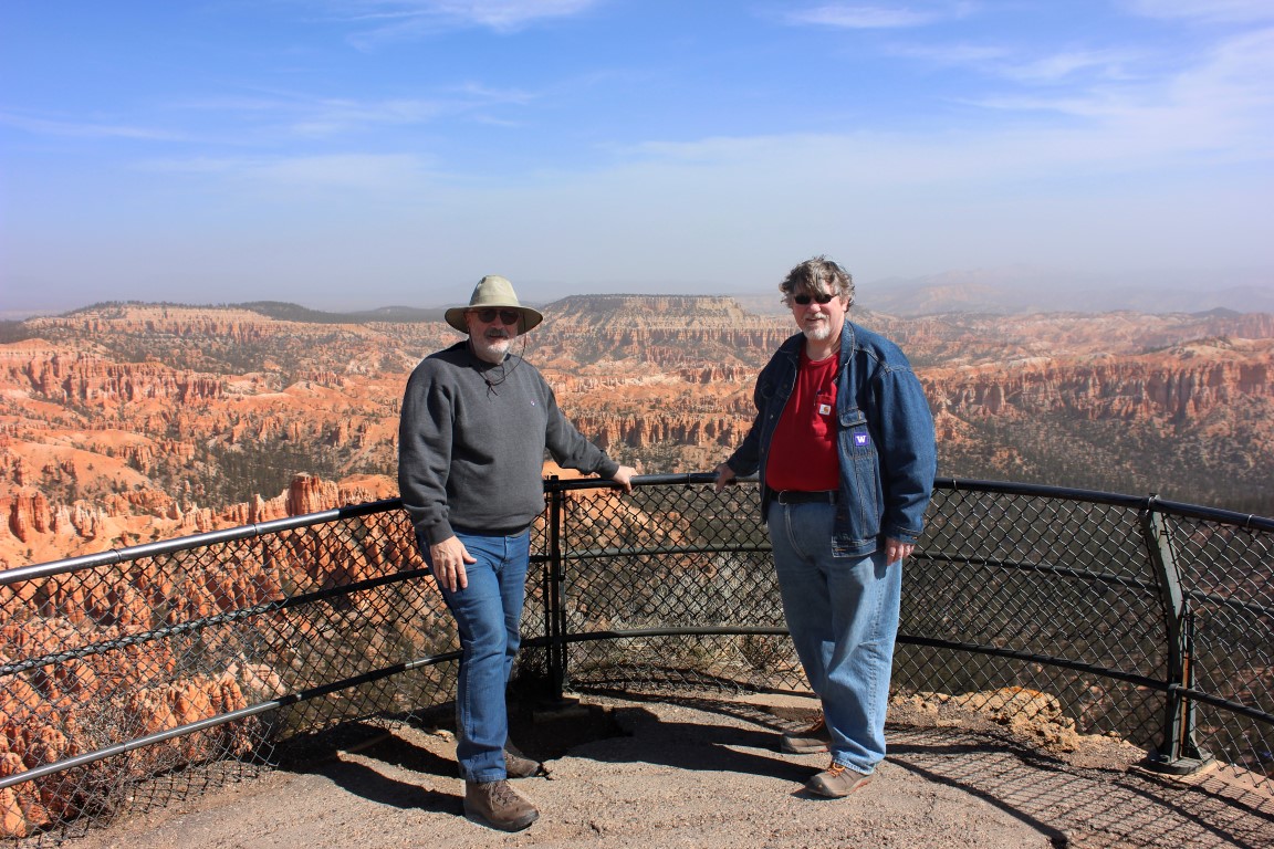
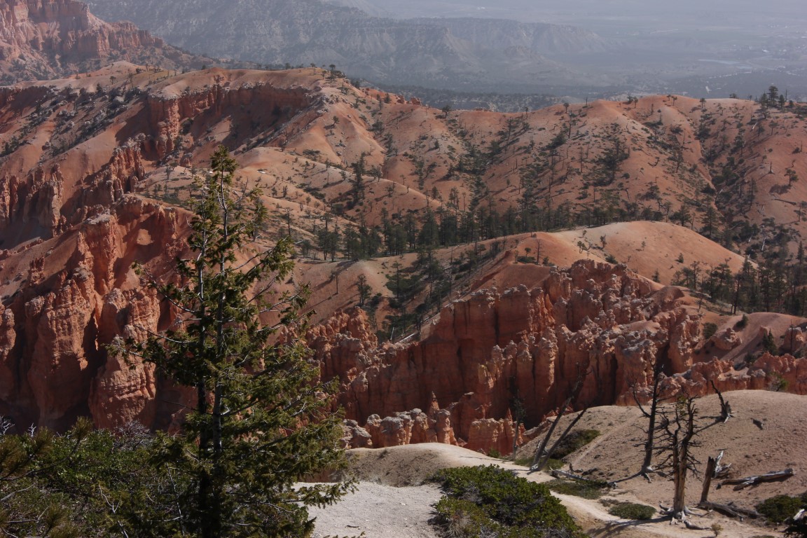
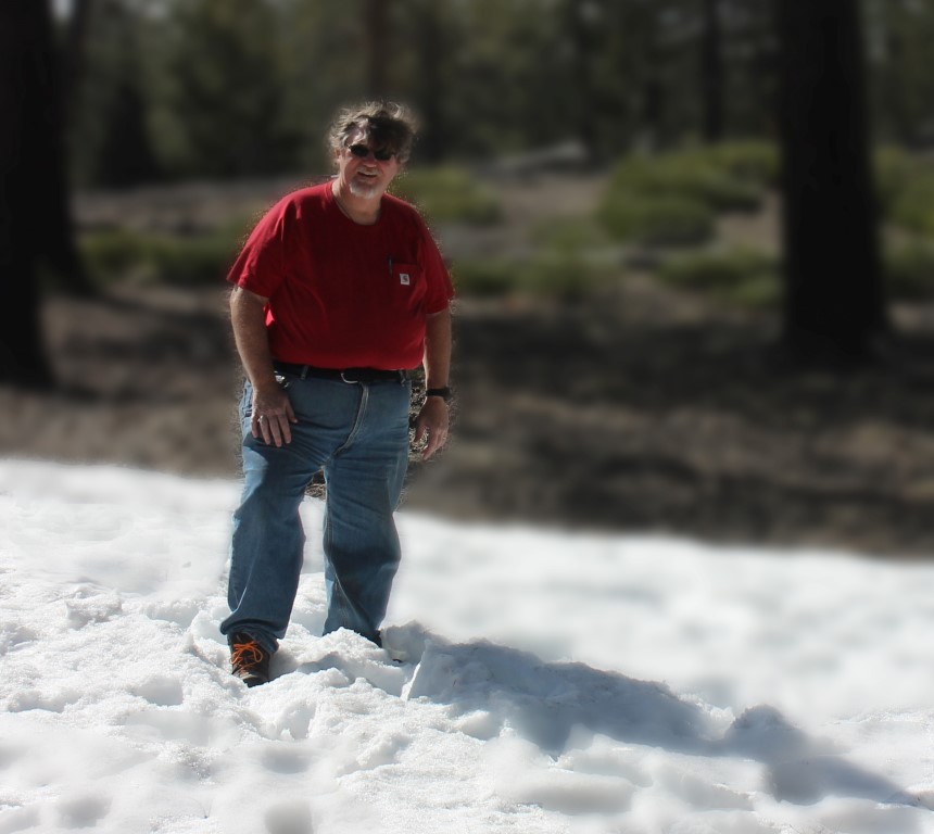 We stopped at the Bryce Point viewpoint (8,300 ft.) at the beginning and then went to the Rainbow Point viewpoint (9,115 ft.) at the far end. There was snow up here! Until we got this high, the weather had been warm.
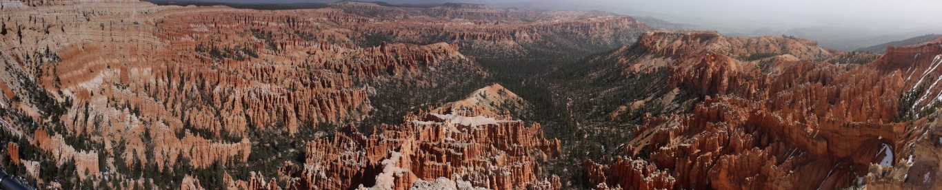
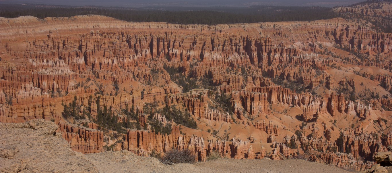
I’m not a fan of panoramic shots in a blog, but there is no way to show this grand landscape without at least some of them. (You can see larger images by clicking on them.)
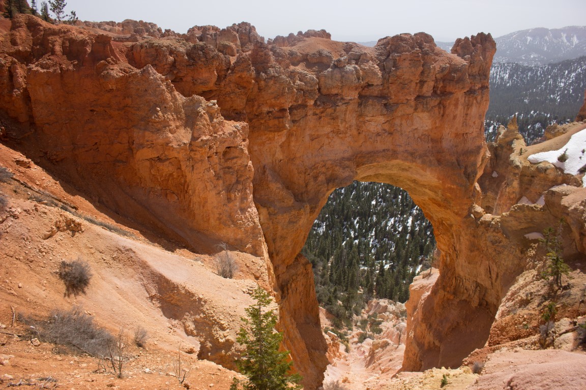
On the way back, we stopped at the Natural Bridge viewpoint and then at the Bryce Canyon Lodge.
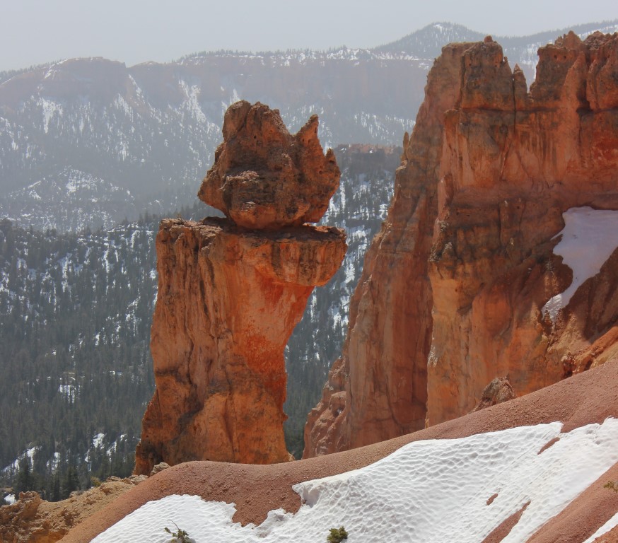
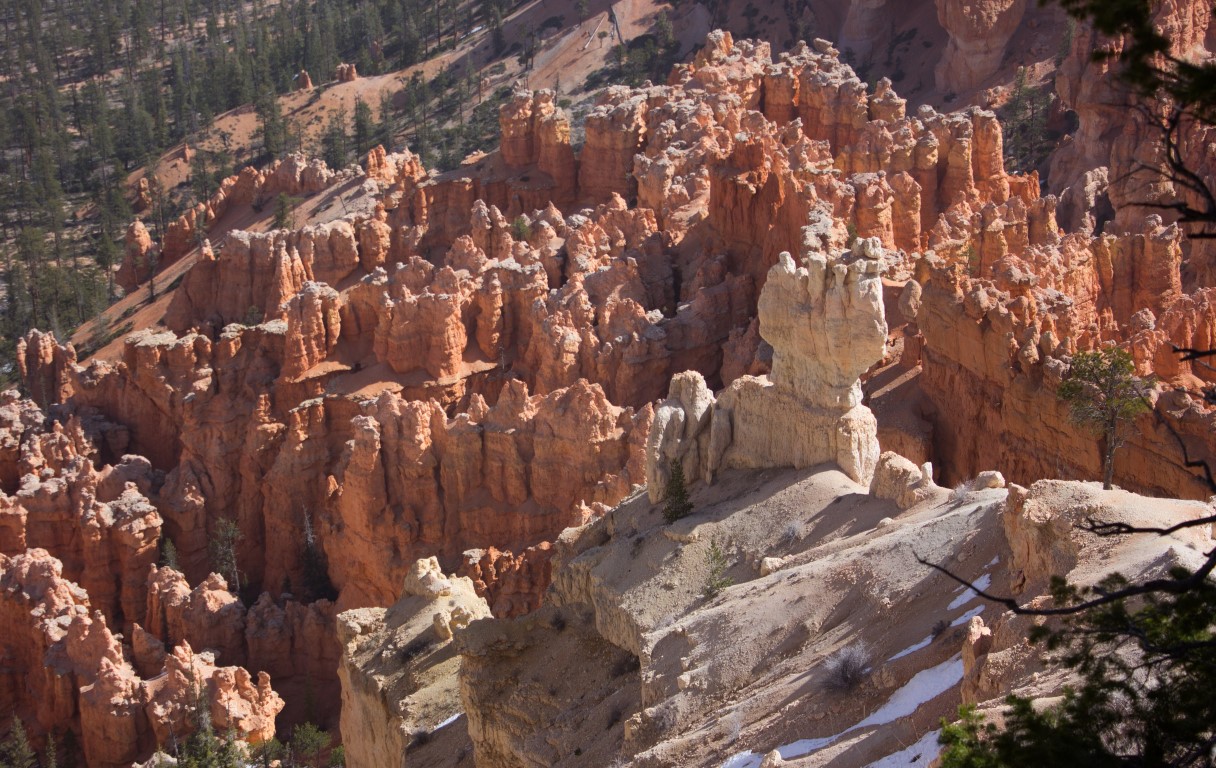
Needless to say, Bryce Canyon is beautiful!
What is really amazing about all of these places is that they are basically layers of red rock in different formations and shades of color, but each one is interesting in a unique way. One thing about the photographs is that it is difficult to capture the view without making a panoramic shot. I’ve taken quite a few series of shots, moving the camera over for each shot, so that I can stitch them together on the computer (as I did in one of the Grand Canyon photos), but these take time to process. It can be hard to see detail in the photos, but it’s the only way of showing the grandeur of the scenery.
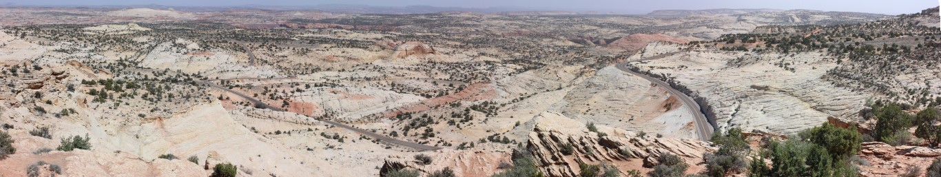 Here is a panorama from one viewpoint in Escalante. If you enlarge the picture, you can see the winding road we would follow. Although the terrain looks like sand dunes, it is all rock. Although it looks flat, the walls of the canyons towered above us in places as we drove through. Unfortunately, we had to stick to the road that day, and only took these shots from one location. But if you do a search for Escalante National Monument, you can see many incredible and unusual formations.

Although Boulder Mountain is over 11,000 ft. high, we reached 9,600 ft. at the summit of Highway 12. There are viewpoints up there that make you feel very small as you survey the vastness of the landscape. I did not have to stitch together multiple pictures to get this panorama from the summit. The view was so vast that even the camera could take it in.
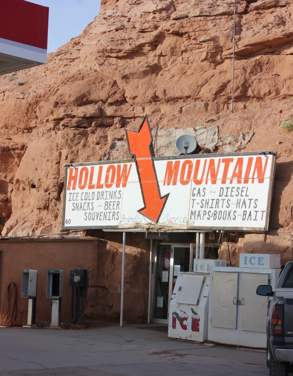 On the way, we stopped at a pitstop at a crossroads. This was an unusual convenience store, either built directly into the rock cliff or built in a cave. It is pretty big inside–about the size of most gas station convenience stores.
We went on through the Capitol Reefs National Park and saw even more spectacular rock formations. I didn’t take any pictures there as it was getting late. This was one of the best overall days of travel for scenery on the whole trip.
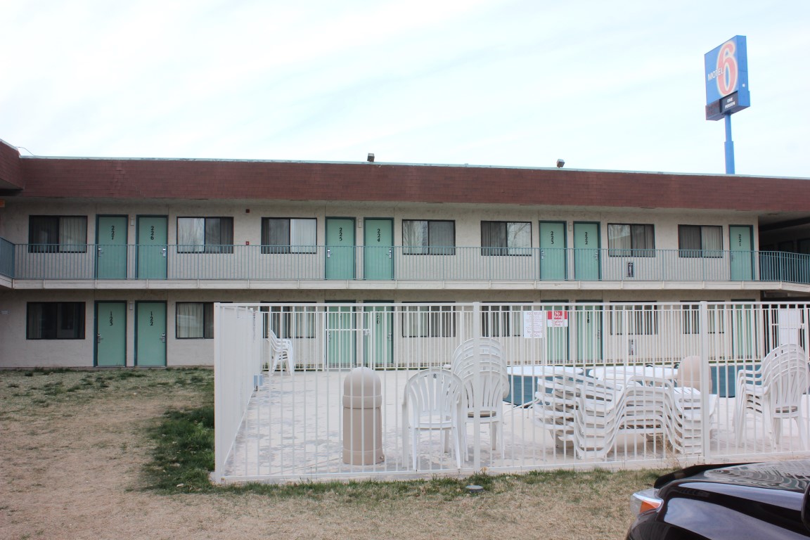 We finally ended at Green River at our luxurious Motel 6, and prepared for the next day’s trip to Arches National Park.